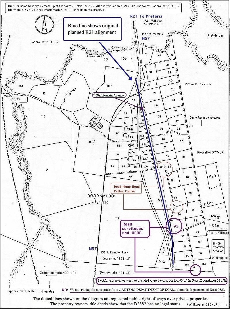
 FIG 1 DKOA_MAP_Sharp Bends & Road Servitudes /Public Right of Ways |
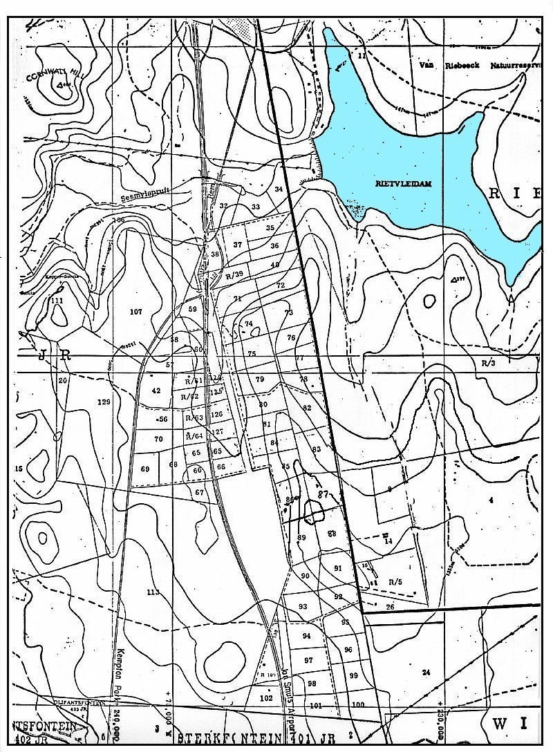 FIG 2 DKOA_MAP_Contours |
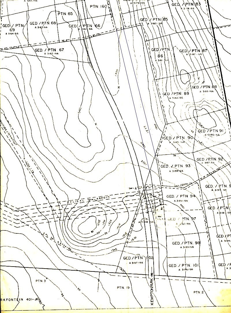 FIG 3 DKOA_MAP_5 metre Contours |
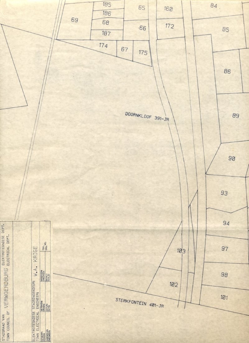 FIG 4 MAP_Centurion Servitude |
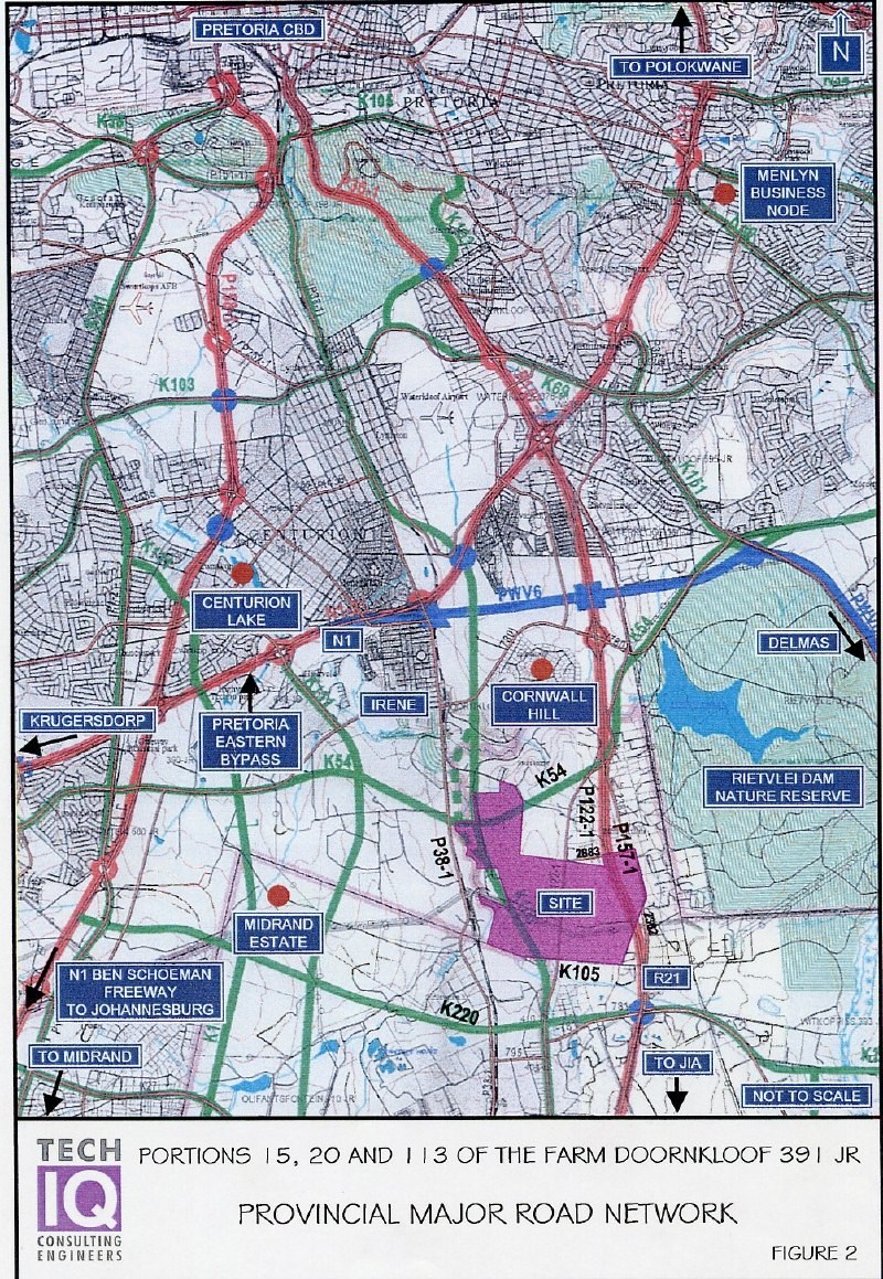 FIG 5 PROPOSED MAJOR ROADS |
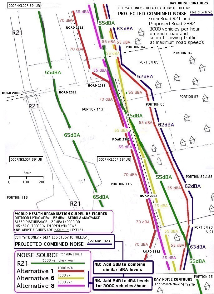 FIG 6 Noise Impact (DayTime Contours) Vehicle noise level exceeds Residential Area Noise Limits by a factor of 10x |
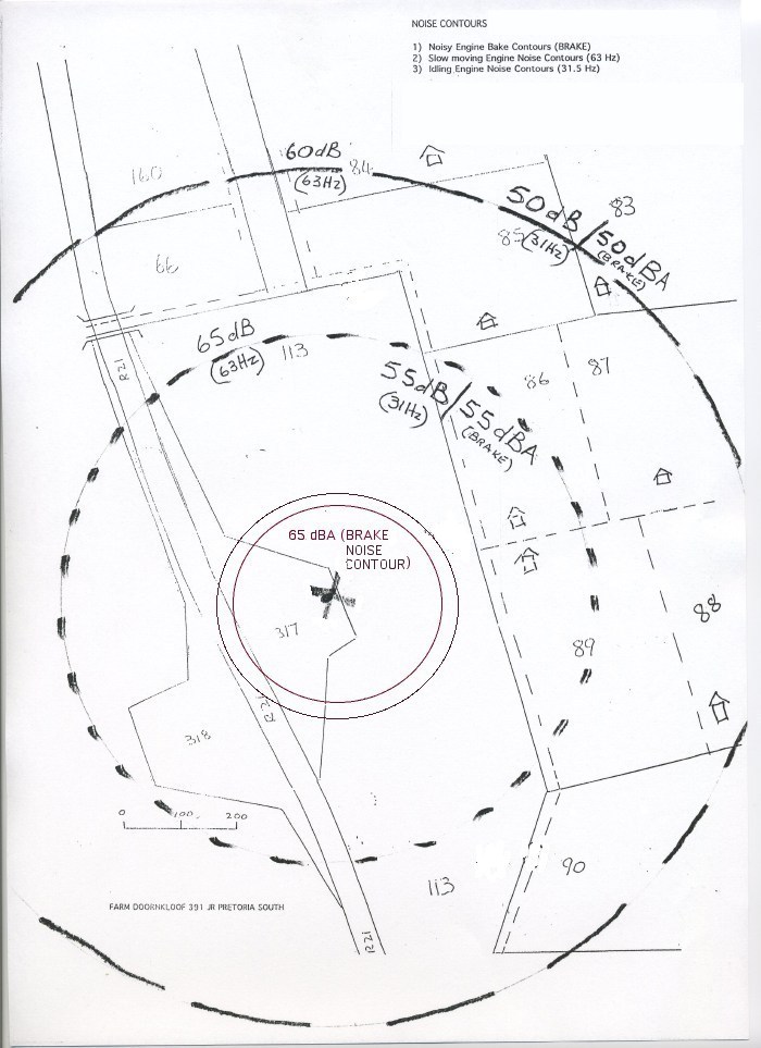 FIG 7 Noise Impact - Truck Brakes and 'Accelerating' Diesel Engine Noise |
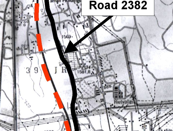 FIG 8 ROAD 2382 |
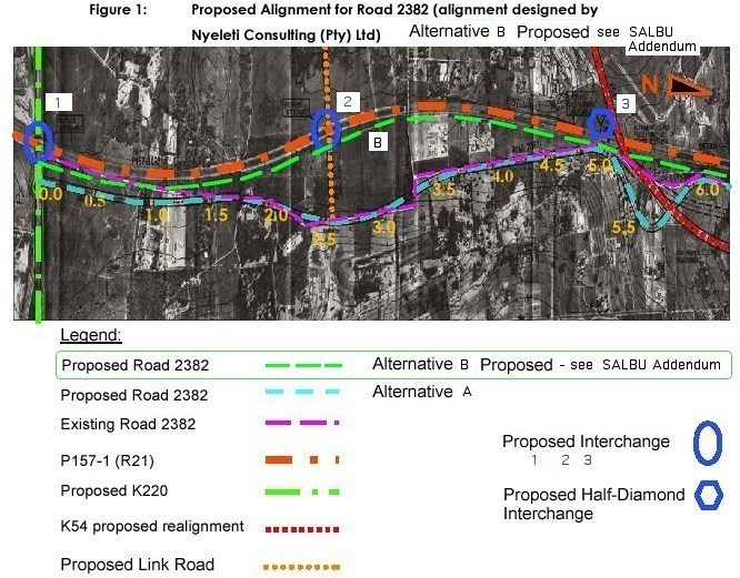 FIG 9 ROAD 2382 _ Proposed Options /Alternatives A&B |
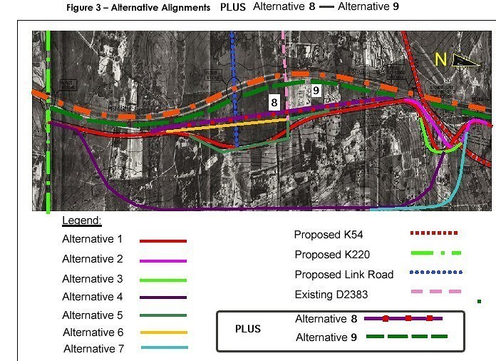 FIG 10 ROAD 2382 _ Proposed Options / Alternatives 1-9 |
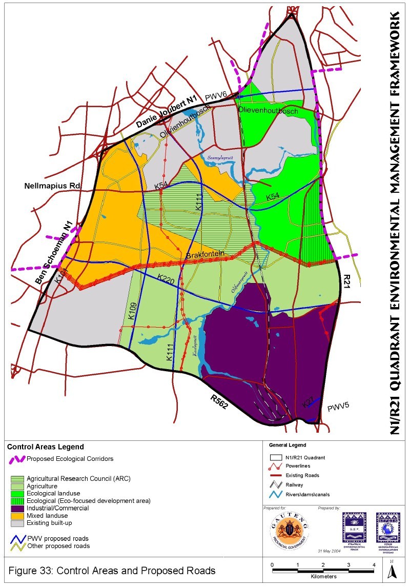 FIG 12 PROPOSED MAJOR ROADS (SEF MAP) |
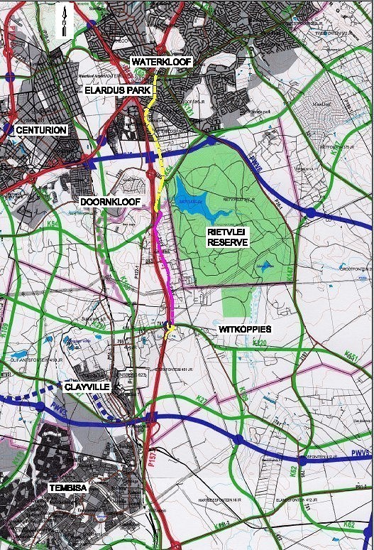 FIG 13 MAJOR ROAD OVERVIEW |
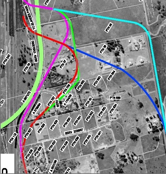 FIG 14 AERIAL VIEW: IMPACT ON GEYER AND OTHERS |
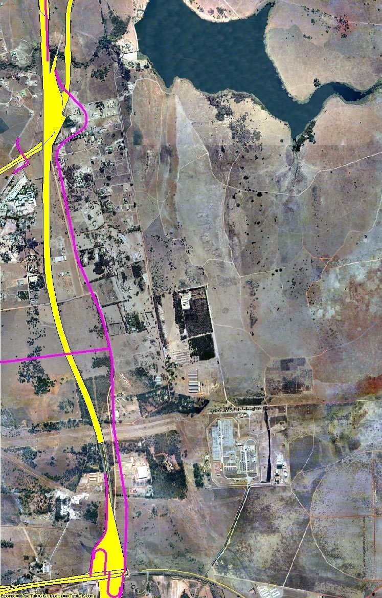 FIG 15 AERIAL VIEW: IMPACT ON DOORNKLOOF (EAST & SOUTH) |
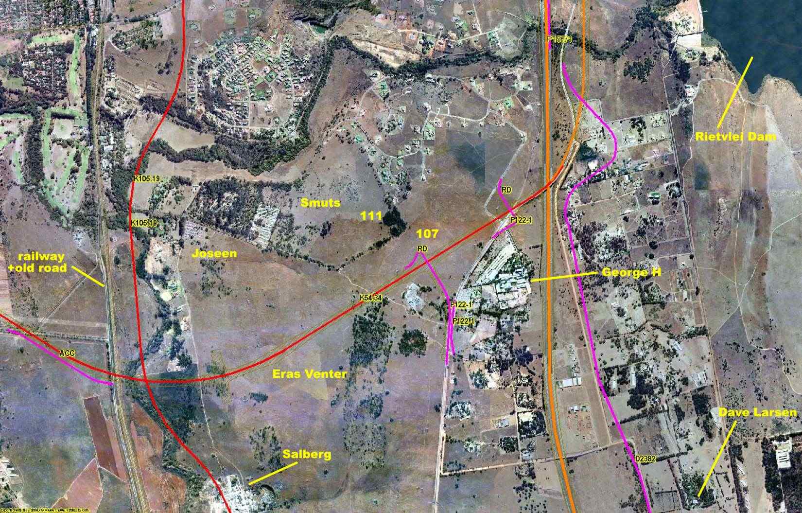 FIG 15B AERIAL VIEW: IMPACT ON DOORNKLOOF (EAST & WEST) |
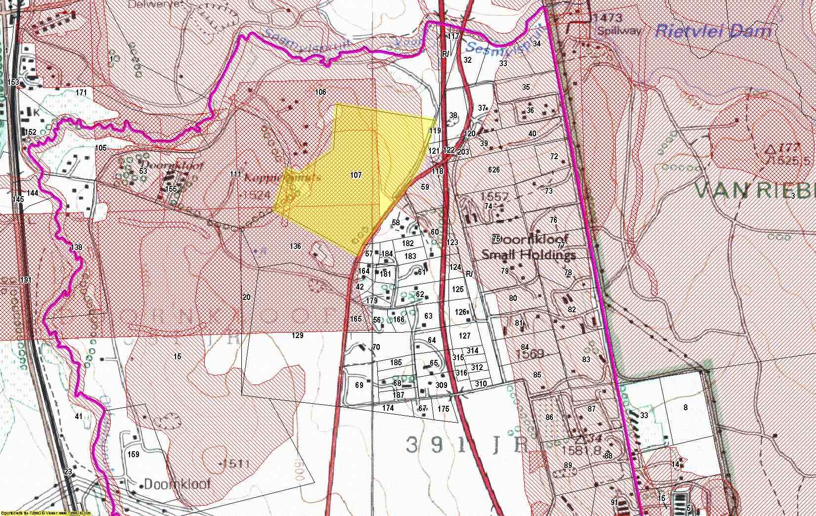 FIG 16 DOORNKLOOF: SENSITIVITE AREAS |
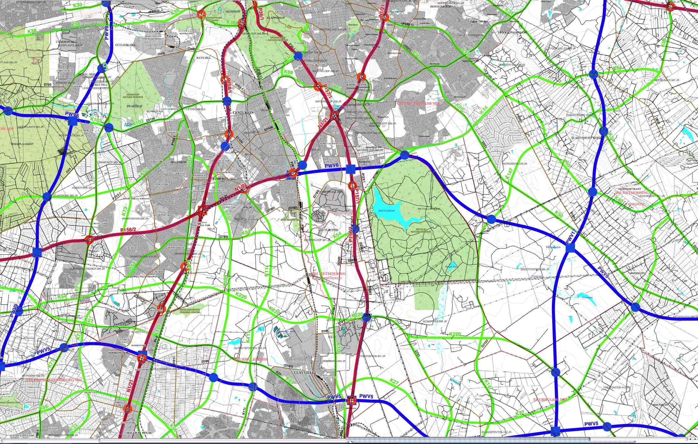 FIG 17 PROPOSED MAJOR ROADS (K54 -Large Map) |
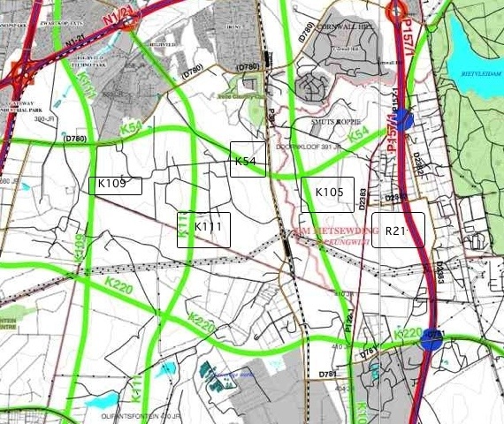 FIG 18 PROPOSED MAJOR ROADS (K54_K109_K111_K105_R21 Small Map) |
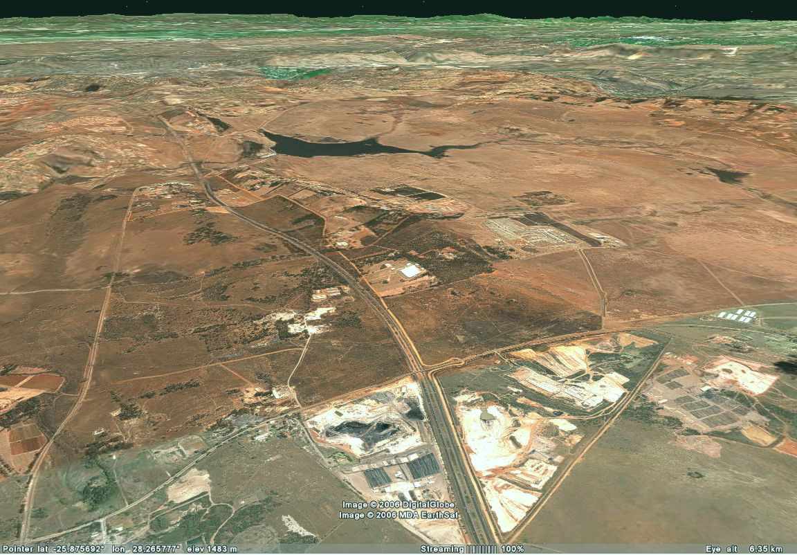 FIG 19 AERIAL VIEW A: DOORNKLOOF EAST (R21 & D2382) |
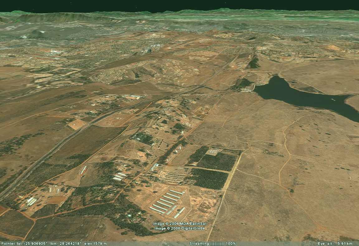 FIG 20 AERIAL VIEW B: DOORNKLOOF EAST (R21 & D2382) |